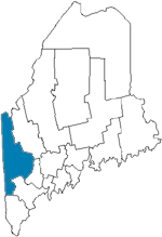
| Name | Size/Acres | Max Depth/ft. | Maine Atlas Map # |
| Anasagunticook Lake | 568 | 54 | 11 |
| Aziscohus Lake | 6,700 | 60 | 28 |
| B Pond | 471 | 110 | 18 |
| Bear Pond | 218 | 72 | 10 |
| Beaver Pond | 128 | 8 | 4 |
| Beaver Pond | 179 | 72 | 18 |
| Bickford Pond | 237 | 69 | 4 |
| Big Concord Pond | 135 | 12 | 11 |
| Bryant Pond | 278 | 63 | 10 |
| C Pond | 173 | 36 | 18 |
| Colcord Pond | 304 | 105 | 4 |
| Ellis Pond | 896 | 43 | 18 |
| Granger Pond | 125 | 28 | 4 |
| Hogan Pond | 177 | 34 | 11 |
| Horseshoe Pond | 132 | 40 | 10 |
| Howard Pond | 109 | 118 | 18 |
| Keewaydin Lake | 307 | 52 | 10 |
| Kecka Lake | 467 | 42 | 10 |
| Keys Pond | 192 | 42 | 10 |
| Kezar Lake | 2,510 | 155 | 10 |
| Kezar Pond | 1,447 | 12 | 4,10 |
| Labrador Pond | 115 | 13 | 11 |
| Lincoln Pond | 340 | 95 | 28 |
| Little Ellis Pond | 297 | 41 | 18 |
| Little Moose Pond | 181 | 43 | 10 |
| Long Pond | 473 | 42 | 10 |
| Lovewell Pond | 1,065 | 45 | 4 |
| Lower Kimball Pond | 486 | 65 | 10 |
| Marshall Pond | 102 | 41 | 11 |
| Mooselookmeguntic Lake | 16,300 | 132 | 18,28 |
| Moose Pond | 160 | 16 | 11 |
| North Pond | 147 | 10 | 10,11 |
| North Pond | 128 | 50 | 11 |
| North Pond | 284 | 50 | 11 |
| Parmachenee Lake | 912 | 93 | 28 |
| Pennesseewassee Lake | 922 | 48 | 10,11 |
| Pleasant Pond | 239 | 15 | 4 |
| Pleasant Pond | 115 | 14 | 11 |
| Pond in the River | 512 | 40 | 18 |
| Richardson Lake | 7,100 | 100 | 18 |
| Sand Pond | 141 | 56 | 10 |
| Saturday Pond | 178 | 25 | 11 |
| Songo Pond | 224 | 25 | 10 |
| South & Rounds Pond | 284 | 71 | 10 |
| Stanely Pond | 137 | 75 | 4 |
| Sterns Pond | 255 | 47 | 10 |
| Sturtenant Pond | 518 | 58 | 17 |
| Thompson Lake | 4,426 | 121 | 5,11 |
| Twitchell Pond | 158 | 47 | 10 |
| Umbagog Lake | 7,850 | 48 | 17 |
| Virginia Lake | 128 | 26 | 10 |
| Walden Pond | 256 | 44 | 4 |
| West Richardson Pond | 423 | 41 | 28 |
| Whitney Pond | 170 | 24 | 11 |
| Worthley Pond | 354 | 49 | 11 |

